


Taken years ago. Top image is of the Manhattan Bridge-from the Brooklyn side of East River (DUMBO are= Down Under the Manhattan Bridge Overpass).
Bottom Image: Brooklyn Bridge in background – taken 2012.


West Duwamish River
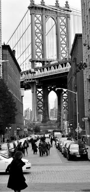
Manhattan Bridge
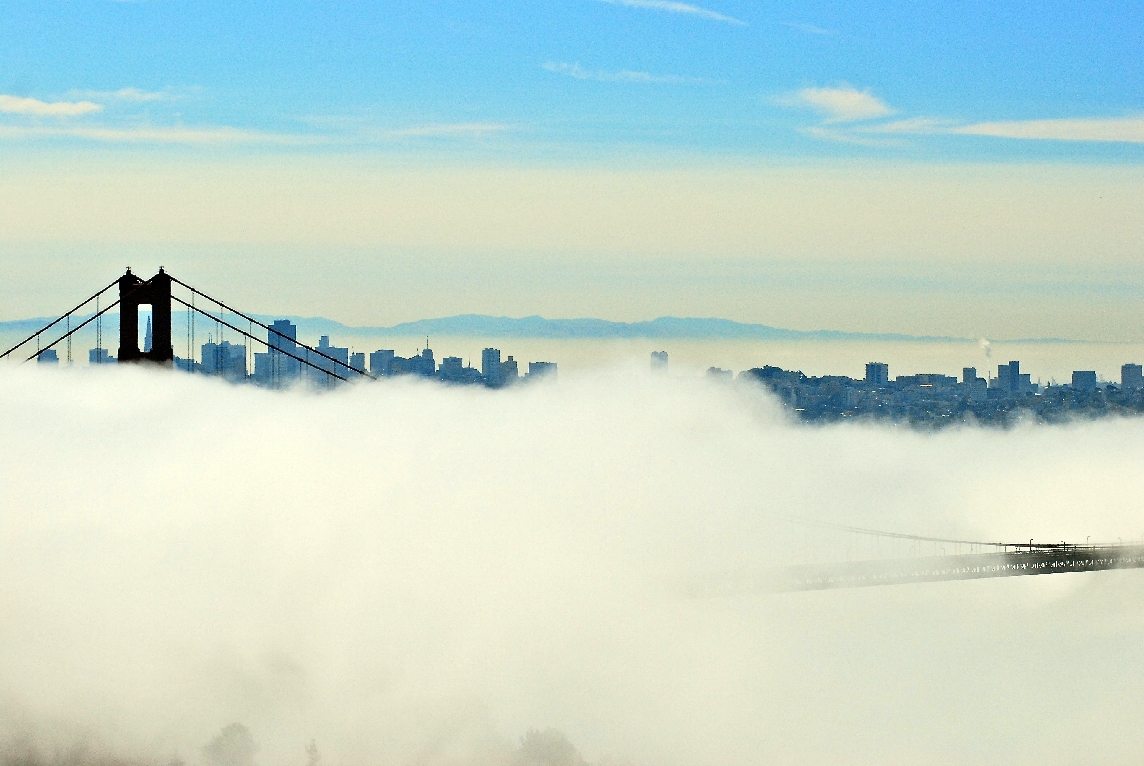
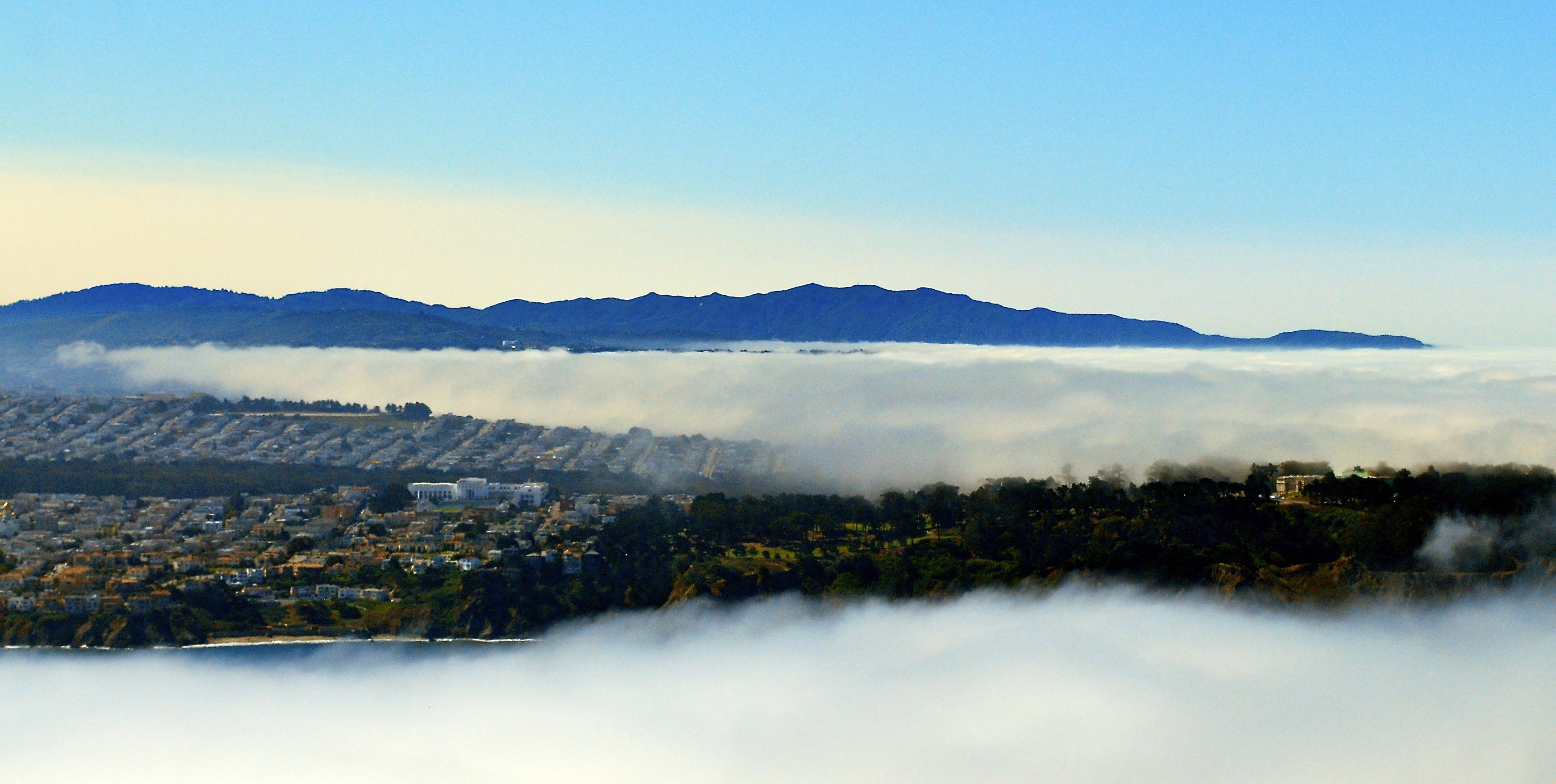
Fog rolling in to San Francisco Bay.


These were taken during one of the less-smokey days we had this summer. Still, the visibility is affected. The BC forest fires robbed us of many nice, summer days.
Shot from the Jose Rizal Bridge in Seattle.
 Ivy seems to be able to grow anywhere, including bridge supports.
 From the Lucille St. bridge, looking NW. Some of rail lines leading into Seattle. Some of the spurs off of these main lines are not in use today as industries have relocated outside the city limits or just closed down.
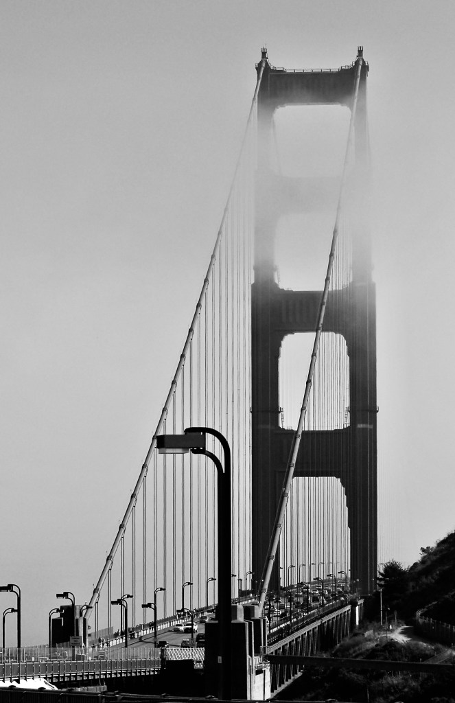
 The Golden Gare Bridge, taken 15 years ago, looking upward. Shot using my Minolta x-700 35mm film camera.


After getting past a No Trespassing sign and fence I was able to get a closer look at this closed pedestrian pier and dock. In the background of one of the images you can see the West Seattle high-rise bridge. This bridge was a replacement for a drawbridge that was hit by a ship back in the 1980’s, I believe.


Rippling water wake of large barge. What appeared to me as abandoned piers. One of them was a pedestrian pier that is now barricaded. To access the abandoned piers I had to ‘overlook’ a No Trespassing sign :-). Trespassing is pretty common to get into abandoned places or ones of high risk. My next post will take a closer look at the abandoned pier in the “No Trespassing” Zone.


The image with the bridge is a northwestern view. The bridge is the West Seattle High Rise. The image with the most clouds is a southern view.
The Duwamish River is a working river as well as one used for transit out into Elliott Bay by fisherman and recreational use. The next posting will highlight some of those activities.


Brooklyn, NYC.
Committed to amplifying underground independent sounds.
We Live In A Dynamic Universe of Energy
Finding the Extraordinary in Ordinary, Everyday Life
The Dedicated Blog for Inga Maria Hauser
Taking Control... Learning Contentment
Street and Urban Explorer Photography
Just another WordPress.com site
The Truth Sets Us Free
A daily selection of the best content published on WordPress, collected for you by humans who love to read.
Street and Urban Explorer Photography
Child Abuse and the Occult
The Random Things We See
Street and Urban Explorer Photography


