
Tag: Duwamish River


Flood Mitigation 2022/23: South Park, Seattle.


One of the locations that I have been shooting for the past decade is the South Park neighborhood in SW Seattle. Part of the reason for photo documenting this neighborhood is that I actually lived in the area for a short time before starting school. Also, it has been a neighborhood in transition for decades; it’s part residential, part light manufacturing and part indigenous heritage. This makes for an interesting mix.
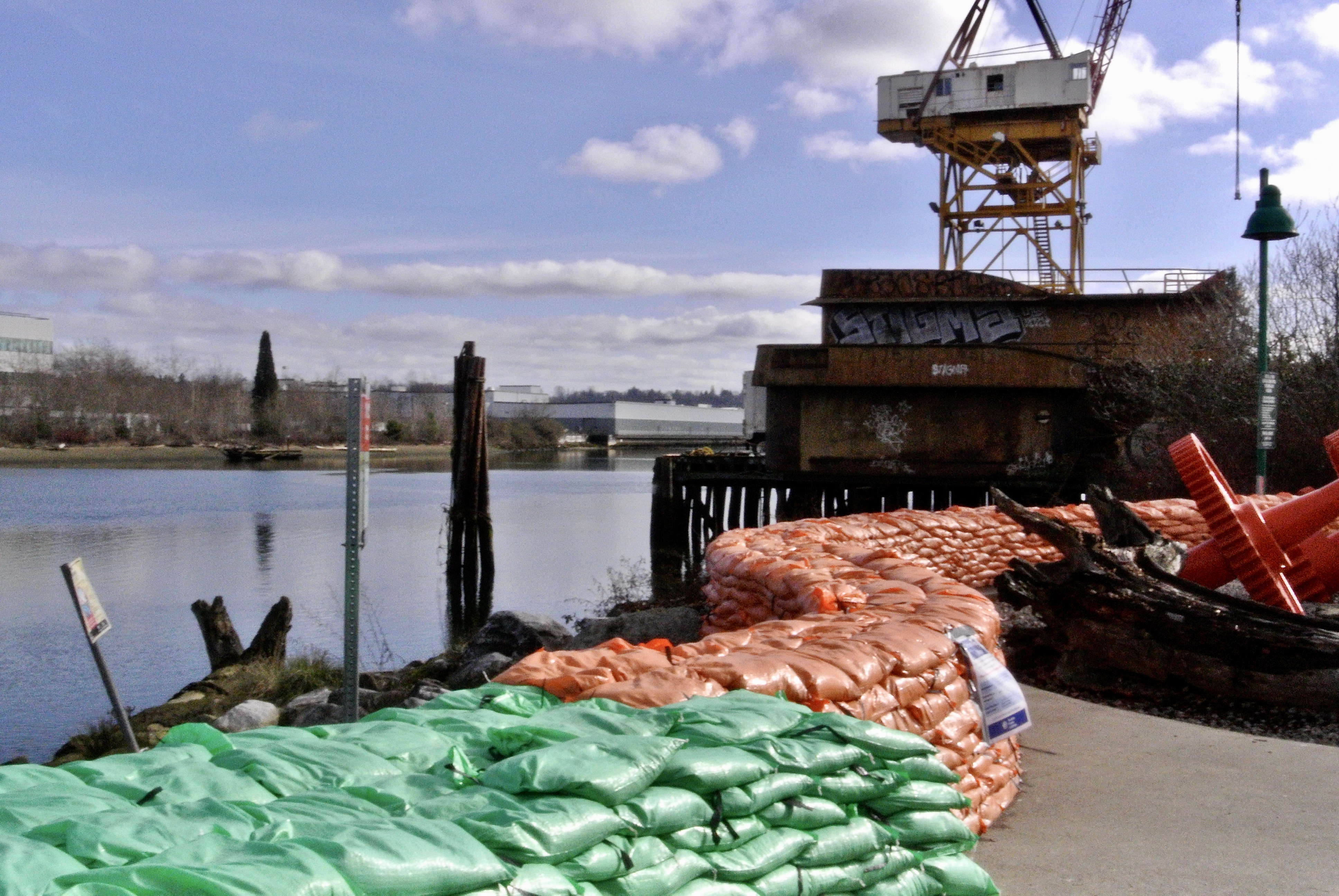
This past winter we had both a very high tide and exceptional rainfall event. The result was that the Duwamish River overflowed its bank by two feet, which caused residential flooding. The city came in with a Laundry Trailer, which is still there, months later. Also, not pictured, is all of the POD units the city brought in for residents to store their non-flooded items. Basements were severely flooded in those houses closest to the river. The sandbags you see ( orange and green) were used to build a three foot wall, unfortunately this was done after the flooding event. The city has left most of the sandbags in place. I’m not sure what the overall plan is, going forward. In all of my years of spending time in this neighborhood I have never seen flood mitigation done on this scale. ( just as an aside- The Duwamish River was the very first EPA Superfund Site. Most of the offending industries have left this area, moving away from the river. However, after 50+ years, it is safe to say the federal government is slow-walking the cleanup. It would take a monumental dredging operation to clean up all of the heavy metals and toxins that have long settled on the river bottom).
I’ve been sitting on these photos and more for months as I just wasn’t sure how to present the after effects of an unusual flood event.
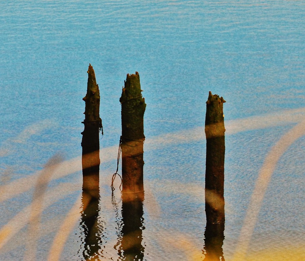
Reflection

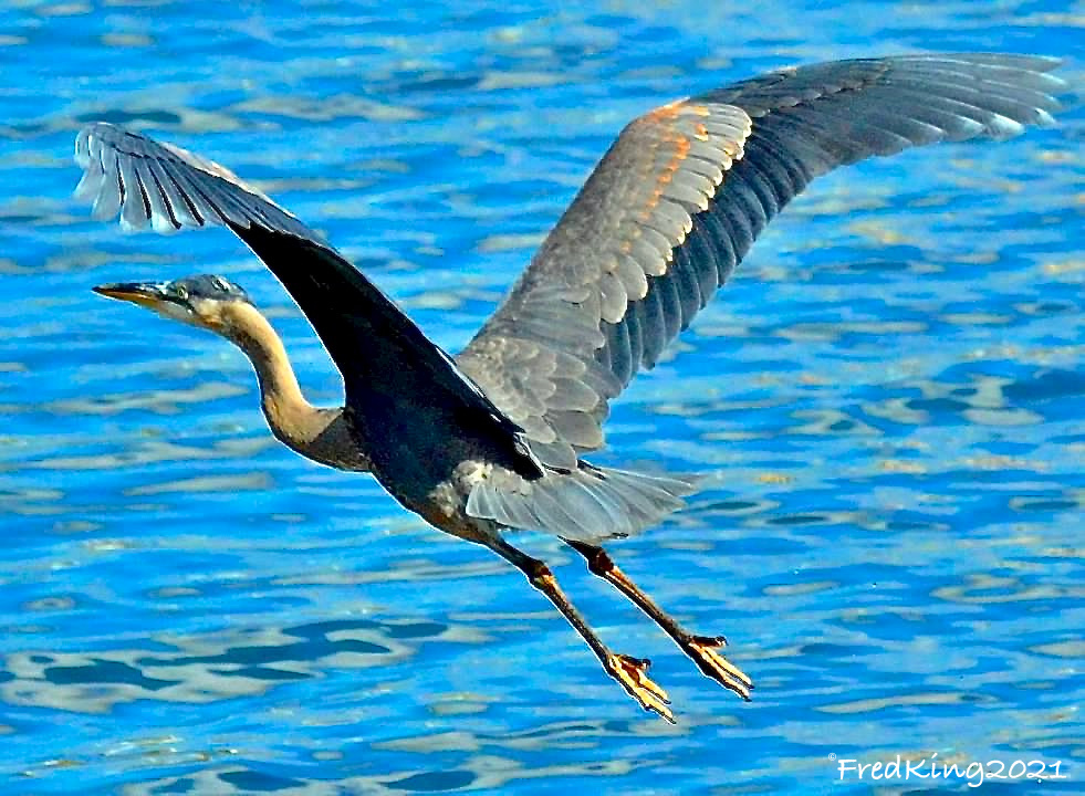
West Duwamish River

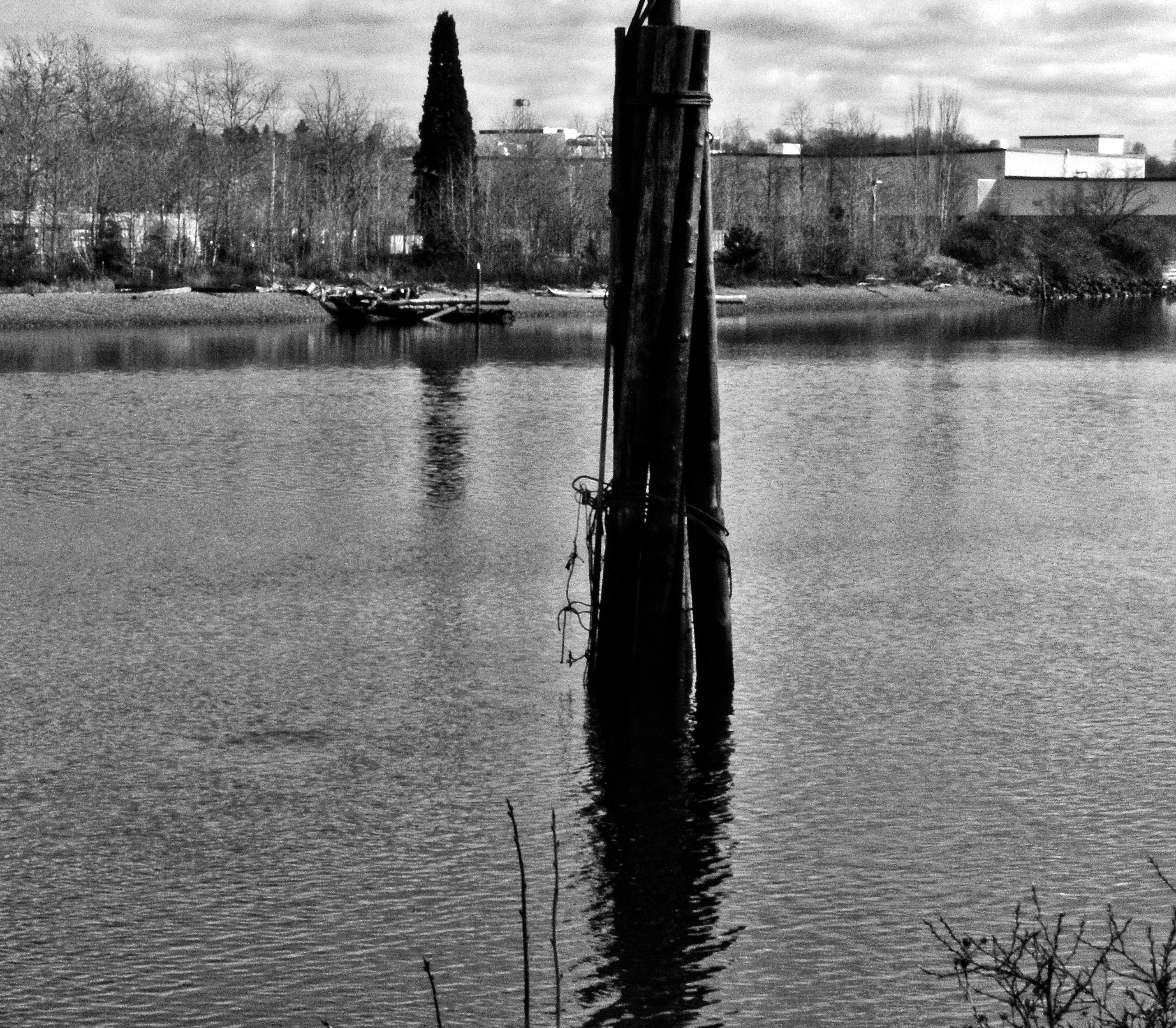
History Repeating

Above photo is of me in 1955 and the lower image is of my grandson, Adam. Same river, 61 years apart.
Almost Film Like Quality

I took this image with my Pentax K-x, which has 12mp as opposed to the Nikon D610 DSLR I usually use. This image almost looks like a film image, maybe due to less pixels as compared to newer DSLR models.
Low tide and a Plane


Low tide on the Duwamish River a couple of weeks ago. This spot is directly under the landing path for Sea Tac Airport. With the exception of the air traffic, this is a fairly serene location I have been coming to for years.
Up River


Some of the marine traffic spotted a few weeks ago on the Duwamish River, Seattle WA.
South Park Changes


The Port of Seattle owns a stretch of land that was once private residences. It’s referred to Pier 117, but there is no pier and the small green space they created was mainly for a large rain garden to keep street runoff out of the Duwamish River. The black and white image, in the foreground, was where two, ramshackle, abandoned houses were located. I have a photo of them somewhere in my archives. They ( the Port) left the two cement pads that the houses were sitting on, for some reason. There is a walking path the length of this ‘park’.
Across the river is I think an abandoned factory, perhaps the old Kenworth plant. Not totally sure. Again, this is the oldest EPA Superfund site in the US.
Across the street from the park is Coffee Umbria, a coffee roaster, etc. Apparently razor wire is needed to protect the business. This particular section of South Park is pretty sketchy, so I understand. I am always on guard and don’t stay in the area very long when I shoot there.
Large Barge


Recently spent a little time around the Duwamish River in South Park, Seattle. This day the river was really high due to runoff in the mountains. The barge looked like an ocean going type, although I’m no barge expert. There are a couple of more steps, in the image, that are usually visible even during high tide.
Note: I used an old, Vivitar wide angle lens on the barge photo.
Cain Bolt and Gasket

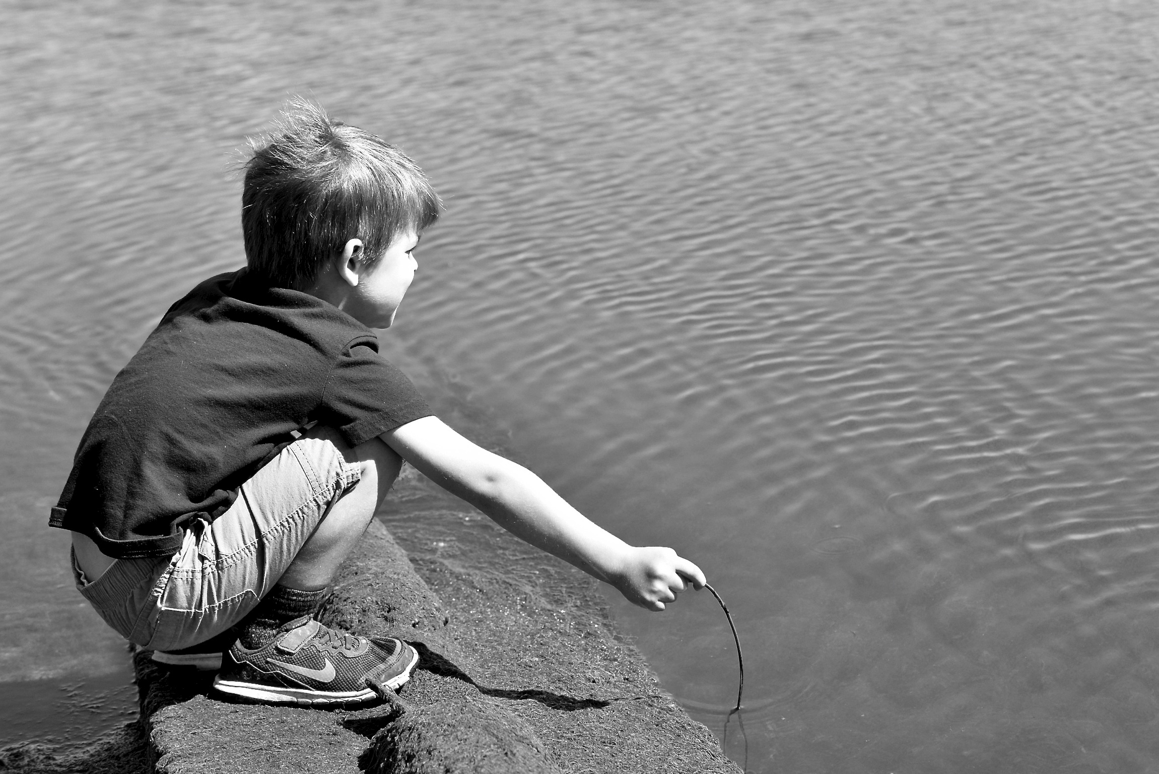
Aug. 1955. Me fishing on the Duwamsh River.


")

I’ve been exploring the South Park area of Seattle on Sundays for 10+ years. It’s a unique mix of light industry and residential that hugs the Duwamish River on the East and the hills, that lead to White Center, on the West. It’s a gritty step back in time. Slowly most of the scrap metal businesses have been shut down, closed or the land sold. In time this area will probably look like many other gentrified neighborhoods, but it will be a slower transition here so it is fun to explore and document what is there now.
When I was four years old I actually lived in South Park for about a year before my parents moved. We lived very close to the river. I have a photo of myself at that age ‘fishing’ on the Duwamish River near our apartment. I think I have posted it, but if not I can do that. One of the few photos of me from my childhood ( see above -I found the image). For some reason I keep coming back to this area of Seattle.


Untitled for Friday


A flowery end to this week.


Duwamish Access VII


After getting past a No Trespassing sign and fence I was able to get a closer look at this closed pedestrian pier and dock. In the background of one of the images you can see the West Seattle high-rise bridge. This bridge was a replacement for a drawbridge that was hit by a ship back in the 1980’s, I believe.
Duwamish Access VI


Rippling water wake of large barge. What appeared to me as abandoned piers. One of them was a pedestrian pier that is now barricaded. To access the abandoned piers I had to ‘overlook’ a No Trespassing sign :-). Trespassing is pretty common to get into abandoned places or ones of high risk. My next post will take a closer look at the abandoned pier in the “No Trespassing” Zone.
