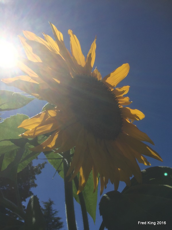
These were taken during one of the less-smokey days we had this summer. Still, the visibility is affected. The BC forest fires robbed us of many nice, summer days.
Shot from the Jose Rizal Bridge in Seattle.

These were taken during one of the less-smokey days we had this summer. Still, the visibility is affected. The BC forest fires robbed us of many nice, summer days.
Shot from the Jose Rizal Bridge in Seattle.


Before the Alaskan Way Viaduct is torn down ( within a year or so) I thought I should get some more photos from the perspective of the Viaduct. Shots like these will be impossible once the demo starts.


From a car.
Finding a way to shoot with a broken foot.


A few years ago the Pike Place Market celebrated its 100th anniversary. One of the more interesting events surrounding this occasion was called Pigs on Parade. Various sculpted pigs were given out to various artists to decorate/paint as they wished. The Pigs would then be placed at various locations in downtown Seattle. I went around one day and photographed as many as I could find in the time frame I had given myself. So, over the next couple of weeks I will be posting those photos. The Golden pig, in this post, was stationed on top of a building in the Market itself.


A sampler of Irish landscapes taken in 2014. The Cliffs of Moher* are behind me and the other three images are from two different spots in the Irish countryside.
*I still haven’t mastered the ‘selfie’.


Just a few blocks from our house this view presents itself. This view is looking southwest along Marine View Drive and Puget Sound. When I took daily walks I would walk along this section of Marine View Drive. One of the perks of living where we do; just a few minutes walk from a pretty cool view. Hasn’t changed much in the 60 years I have lived in Arbor Heights.
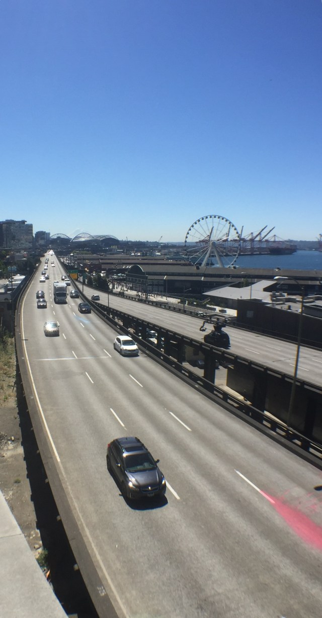 Looking southward along SR99 along the waterfront in Seattle. The Wheel, a few piers and CenturyLink Field in the background. Just behind CenturyLink Field is Mt. Rainier.


As seen through the smoke that blankets Western Washington, the Blue Angels.


Yesterday, on a Chamber of Commerce weather day, we took our two grandkids to the Pike Place Market to have lunch and to check out the refurbed section of the Market. We traveled by bus from West Seattle; I have to insert that I think comparing NYC Subways and Seattle Metro buses is likely close to happening).
Highlights of the images ( which are all shot on my iPhone, with the aid of a detachable lens are: The Wheel, Mt. Rainier, Elliott Bay, Alki Point in West Seattle and the soon-to-become extinct Viaduct/SR99.
One of the highlights of the outing was viewing and contributing to the new Gum Wall!
Anyway, the foray into downtown Seattle for a few of hours was about all my broken down body could endure. The current Seattle agency in charge of tourism promotion of the city seemed to be doing a bang up job as the Market was jam packed, even for a Tuesday!


After getting past a No Trespassing sign and fence I was able to get a closer look at this closed pedestrian pier and dock. In the background of one of the images you can see the West Seattle high-rise bridge. This bridge was a replacement for a drawbridge that was hit by a ship back in the 1980’s, I believe.


Rippling water wake of large barge. What appeared to me as abandoned piers. One of them was a pedestrian pier that is now barricaded. To access the abandoned piers I had to ‘overlook’ a No Trespassing sign :-). Trespassing is pretty common to get into abandoned places or ones of high risk. My next post will take a closer look at the abandoned pier in the “No Trespassing” Zone.


The image with the bridge is a northwestern view. The bridge is the West Seattle High Rise. The image with the most clouds is a southern view.
The Duwamish River is a working river as well as one used for transit out into Elliott Bay by fisherman and recreational use. The next posting will highlight some of those activities.
 This image is from 2010.
Location: LES, Manhattan.
Committed to amplifying underground independent sounds.
We Live In A Dynamic Universe of Energy
Finding the Extraordinary in Ordinary, Everyday Life
The Dedicated Blog for Inga Maria Hauser
Taking Control... Learning Contentment
Street and Urban Explorer Photography
Just another WordPress.com site
The Truth Sets Us Free
A daily selection of the best content published on WordPress, collected for you by humans who love to read.
Street and Urban Explorer Photography
Child Abuse and the Occult
The Random Things We See
Street and Urban Explorer Photography