

Tag: clouds
Wandering Photographer
Trains, planes and automobiles.
Seattle Rail Yard
 From the Lucille St. bridge, looking NW. Some of rail lines leading into Seattle. Some of the spurs off of these main lines are not in use today as industries have relocated outside the city limits or just closed down.
South Park Changes


The Port of Seattle owns a stretch of land that was once private residences. It’s referred to Pier 117, but there is no pier and the small green space they created was mainly for a large rain garden to keep street runoff out of the Duwamish River. The black and white image, in the foreground, was where two, ramshackle, abandoned houses were located. I have a photo of them somewhere in my archives. They ( the Port) left the two cement pads that the houses were sitting on, for some reason. There is a walking path the length of this ‘park’.
Across the river is I think an abandoned factory, perhaps the old Kenworth plant. Not totally sure. Again, this is the oldest EPA Superfund site in the US.
Across the street from the park is Coffee Umbria, a coffee roaster, etc. Apparently razor wire is needed to protect the business. This particular section of South Park is pretty sketchy, so I understand. I am always on guard and don’t stay in the area very long when I shoot there.
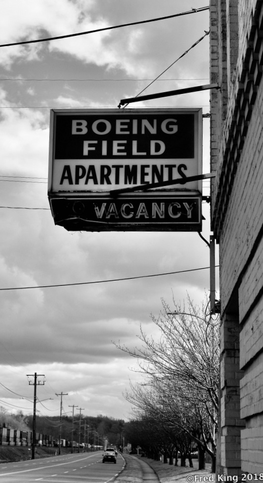
Walking the RR Tracks

Location: Rail road tracks that run parallel to Airport Way So. in Georgetown , Seattle. There’s a blast of steam in the middle of the image coming from a small industrial building. Downtown Seattle in the distance.
More of the graffiti to follow in future posts.
Ireland 2014


SAMSUNG CAMERA PICTURES

SAMSUNG CAMERA PICTURES

A sampler of Irish landscapes taken in 2014. The Cliffs of Moher* are behind me and the other three images are from two different spots in the Irish countryside.
*I still haven’t mastered the ‘selfie’.


Duwamish Access VII


After getting past a No Trespassing sign and fence I was able to get a closer look at this closed pedestrian pier and dock. In the background of one of the images you can see the West Seattle high-rise bridge. This bridge was a replacement for a drawbridge that was hit by a ship back in the 1980’s, I believe.
Duwamish Access V


Large cement/gravel plant along the west side of Duwamish River. On the east side a city of empty containers.
Duwamish River Access II


The image with the bridge is a northwestern view. The bridge is the West Seattle High Rise. The image with the most clouds is a southern view.
The Duwamish River is a working river as well as one used for transit out into Elliott Bay by fisherman and recreational use. The next posting will highlight some of those activities.
Skagit Valley


Tulip season is over, but I still have some images from our trip to the valley north of Seattle, so bear with me as I post another dozen or so images.
Tulip Field, Etc.


Well, what would a tulip farm be without a faux windmill and a herd of Honey Buckets?
Taken at Rozengaard Farm, Mt. Vernon, WA.,in the Skagit Valley.
Rummaging around on a Sunday


")


Rummaging around the South Park neighborhood of Seattle on a Sunday morning.
Marine Traffic


Marine traffic on the East River, NYC.
Views from Central Park


Just a few views looking outward from Central Park in late October, 2016.
Past and Present


Two iconic buildings in Brooklyn. The Brooklyn Public Library and The Old Stone House in Park Slope right across the street from where our son and family live.Both of these images were taken on my iPhone. Every Saturday there is a Farmers/Saturday Market in front of the Library and entrance to Prospect Park and Grand Army Plaza , a confluence of interesting sites to visit. The morning we were at the Market a man with a green flag ran up the steps leading to the library entrance and started waving this flag. I have no idea what it was about, but someone was videotaping his actions. ??
Two Bridges


The Manhattan and Brooklyn Bridges. Taken while in Brooklyn last week.
Morning from Brooklyn Bridge Park
 On a very blustery morning. Walking the Brooklyn Bridge Park this morning and took this shot of Manhattan across the East River.
Ominous Clouds

Processed with Snapseed.

Yesterday we were at the Evergreen State Fair in Monroe, WA. There was some dramatic weather swings while there, including these ominous-looking clouds.
