


A few years ago the Pike Place Market celebrated its 100th anniversary. One of the more interesting events surrounding this occasion was called Pigs on Parade. Various sculpted pigs were given out to various artists to decorate/paint as they wished. The Pigs would then be placed at various locations in downtown Seattle. I went around one day and photographed as many as I could find in the time frame I had given myself. So, over the next couple of weeks I will be posting those photos. The Golden pig, in this post, was stationed on top of a building in the Market itself.
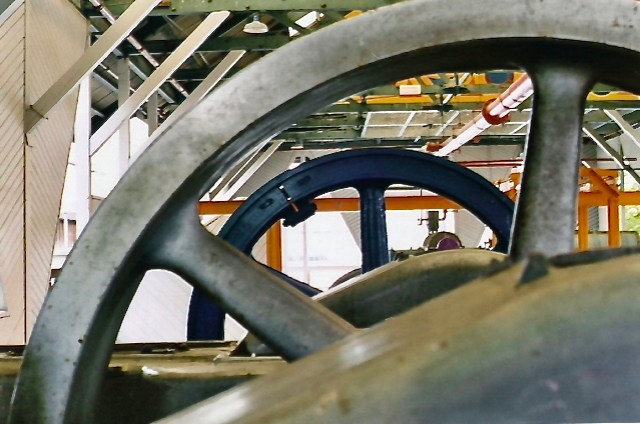
I shot this years ago, on my Minolta X-700 35mmSLR, at Gas Works Park in Seattle. I was taking a photography workshop and they did field trips on the weekends. We met up at different locations and just wandered around, shooting whatever we wanted. If you ever run across a group of lost-looking photographers wandering about a public space, it is probably a class or workshop on a field trip or exercise.
PS: Eight months on and I’m still wearing a boot due to the fractured 4th metatarsal bone. I haven’t been out much with my camera. Poor weather ( typical for Seattle) is also a factor. So, I’ve dug into the archives and re-edited some old film images to post. Just for those doubters, here is the latest X-ray of right foot taken two weeks ago. Little or no healing, so I am now using a device called a Bone Stimulator that attaches to the foot, directly over the fracture. The theory is: wave pulses are sent to the affected area, which is supposed to increase blood flow which = bone growth. Hoping it works!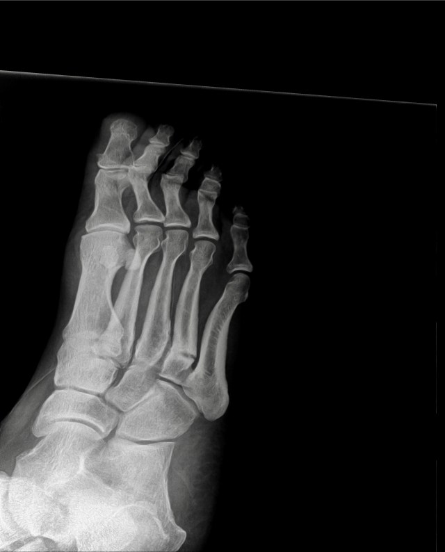


Just a few blocks from our house this view presents itself. This view is looking southwest along Marine View Drive and Puget Sound. When I took daily walks I would walk along this section of Marine View Drive. One of the perks of living where we do; just a few minutes walk from a pretty cool view. Hasn’t changed much in the 60 years I have lived in Arbor Heights.

Aug. 1955. Me fishing on the Duwamsh River.


")

I’ve been exploring the South Park area of Seattle on Sundays for 10+ years. It’s a unique mix of light industry and residential that hugs the Duwamish River on the East and the hills, that lead to White Center, on the West. It’s a gritty step back in time. Slowly most of the scrap metal businesses have been shut down, closed or the land sold. In time this area will probably look like many other gentrified neighborhoods, but it will be a slower transition here so it is fun to explore and document what is there now.
When I was four years old I actually lived in South Park for about a year before my parents moved. We lived very close to the river. I have a photo of myself at that age ‘fishing’ on the Duwamish River near our apartment. I think I have posted it, but if not I can do that. One of the few photos of me from my childhood ( see above -I found the image). For some reason I keep coming back to this area of Seattle.
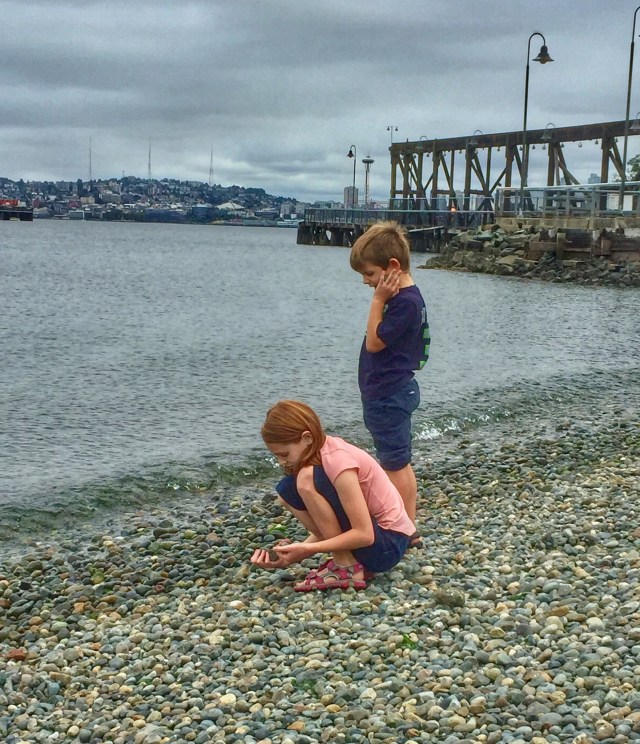 Two of our grandchildren exploring the beach at Jack Block Park on Elliott Bay in Seattle. Although the water was frigid they did wade in for a brief moment :-). Today they are back in school with the rest of the Seattle students. I had a fun summer watching them. although a bit crazy at times. Madeleine starts the 4th grade and Adam first grade. Seem like not so long ago I was changing their diapers!
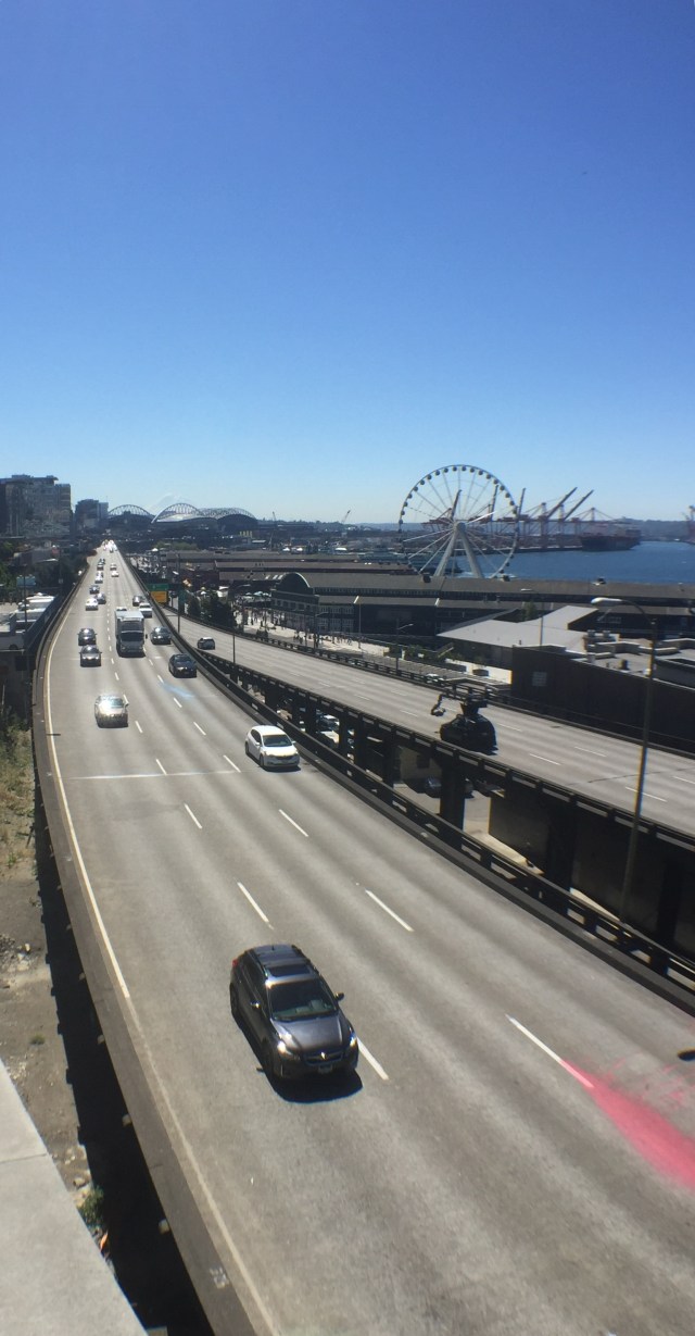 Looking southward along SR99 along the waterfront in Seattle. The Wheel, a few piers and CenturyLink Field in the background. Just behind CenturyLink Field is Mt. Rainier.


As seen through the smoke that blankets Western Washington, the Blue Angels.


Yesterday, on a Chamber of Commerce weather day, we took our two grandkids to the Pike Place Market to have lunch and to check out the refurbed section of the Market. We traveled by bus from West Seattle; I have to insert that I think comparing NYC Subways and Seattle Metro buses is likely close to happening).
Highlights of the images ( which are all shot on my iPhone, with the aid of a detachable lens are: The Wheel, Mt. Rainier, Elliott Bay, Alki Point in West Seattle and the soon-to-become extinct Viaduct/SR99.
One of the highlights of the outing was viewing and contributing to the new Gum Wall!
Anyway, the foray into downtown Seattle for a few of hours was about all my broken down body could endure. The current Seattle agency in charge of tourism promotion of the city seemed to be doing a bang up job as the Market was jam packed, even for a Tuesday!
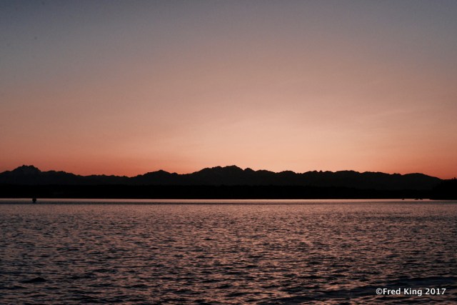 Looking towards the Olympic Mountains from Puget Sound.


A couple of weeks ago I went to a spot on the east side Duwamish River that I didn’t know existed. Much of what I have posted, regarding the Duwamish River over the years, has been taken from the west side at various locations. The Port of Seattle owns this access point, adjacent to the new Federal Building above ( something else I had no idea existed as it is set quite a ways back from East Marginal Way).


This area, like many along the Duwamish River, used to be inhabited by indigenous peoples. Rich in history that is almost totally overlooked by Seattleites today. I know the signs are not readable in the photos, but if you can zoom in and maybe find a few keywords to Google, you might be able to dive deeper into the history of this area. The Duwamish River used to snake its way down to Elliott Bay, but in the past ( probably for reasons of commerce) the river’s curvy path was straightened out to what it is today.
The Duwamish River, which I find fascinating, is the first EPA Superfund Site in the US and is still a work in progress 47 years on. This says something about the scope of cleaning a river estuary. Although the area is much cleaner and less polluted today, it still has a way to go. Many of the heavy polluting businesses that were located along the river have since moved or closed down. I think dredging the river bottom is not a possibility as it would stir up much of the heavy metals, etc. Similarly, in Brooklyn, NYC, I have been following the efforts to clean up the Gowanus Canal, which was declared a superfund site a few years ago. This past Fall, a Portland, Oregon company was awarded the first contract to do a superficial dredging to remove debris that was sitting on the bottom of one small section of the canal, without disturbing the sediment. I was there the week this was being done. It was just a pilot project, but was fascinating to watch. A rep from the Portland company was on site to both watch over the pilot dredging, but to be available to answer questions from the public ( such as me, who pestered her for about 30 minutes, till it started to rain). The Portland company actually contracted with the company that dredged the Love Canal decades ago, as they had the expertise and equipment to perform this sensitive work. With the new administration coming in last January, all work on the Gowanus Canal is up in the air, even though monies were allocated to get the project going.
If interested, there is a lot of info online. If you dig back in my posts to around last November ( 11th and 13th) I think I posted a few photos of the initial dredging of the small section of the Gowanus Canal. I also did a couple of Facebook check-in type postings showing the barge and crane at work.
Will be posting more from this site on the Duwamish River over the next couple of weeks. My apologies for getting a bit sidetracked. There are similarities between the two sites that I find fascinating.


Well, what would a tulip farm be without a faux windmill and a herd of Honey Buckets?
Taken at Rozengaard Farm, Mt. Vernon, WA.,in the Skagit Valley.


Location: South of Ellensburg, WA. Deserted building along a rail spur in Eastern Washington.


At this spot on the Yakima River there is a rail bridge over a small stream that feeds into the river. A fun spot to explore, but not when a train is passing through.
Committed to amplifying underground independent sounds.
We Live In A Dynamic Universe of Energy
Finding the Extraordinary in Ordinary, Everyday Life
The Dedicated Blog for Inga Maria Hauser
Taking Control... Learning Contentment
Street and Urban Explorer Photography
Just another WordPress.com site
The Truth Sets Us Free
A daily selection of the best content published on WordPress, collected for you by humans who love to read.
Street and Urban Explorer Photography
Child Abuse and the Occult
The Random Things We See
Street and Urban Explorer Photography


