Trains, planes and automobiles.
 From the Lucille St. bridge, looking NW. Some of rail lines leading into Seattle. Some of the spurs off of these main lines are not in use today as industries have relocated outside the city limits or just closed down.


The Port of Seattle owns a stretch of land that was once private residences. It’s referred to Pier 117, but there is no pier and the small green space they created was mainly for a large rain garden to keep street runoff out of the Duwamish River. The black and white image, in the foreground, was where two, ramshackle, abandoned houses were located. I have a photo of them somewhere in my archives. They ( the Port) left the two cement pads that the houses were sitting on, for some reason. There is a walking path the length of this ‘park’.
Across the river is I think an abandoned factory, perhaps the old Kenworth plant. Not totally sure. Again, this is the oldest EPA Superfund site in the US.
Across the street from the park is Coffee Umbria, a coffee roaster, etc. Apparently razor wire is needed to protect the business. This particular section of South Park is pretty sketchy, so I understand. I am always on guard and don’t stay in the area very long when I shoot there.

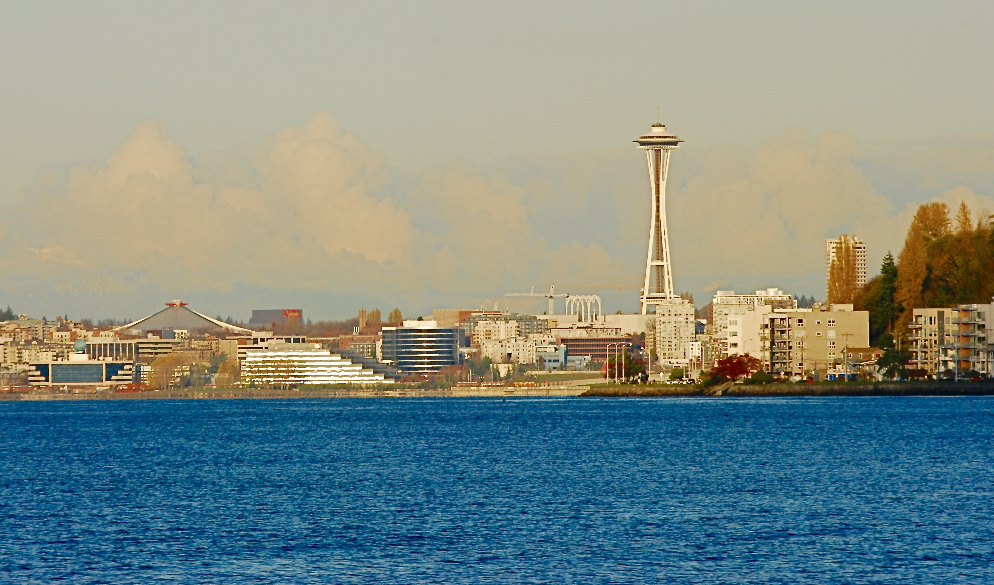
Location: Rail road tracks that run parallel to Airport Way So. in Georgetown , Seattle. There’s a blast of steam in the middle of the image coming from a small industrial building. Downtown Seattle in the distance.
More of the graffiti to follow in future posts.


Recently spent a little time around the Duwamish River in South Park, Seattle. This day the river was really high due to runoff in the mountains. The barge looked like an ocean going type, although I’m no barge expert. There are a couple of more steps, in the image, that are usually visible even during high tide.
Note: I used an old, Vivitar wide angle lens on the barge photo.


A sampler of Irish landscapes taken in 2014. The Cliffs of Moher* are behind me and the other three images are from two different spots in the Irish countryside.
*I still haven’t mastered the ‘selfie’.


After getting past a No Trespassing sign and fence I was able to get a closer look at this closed pedestrian pier and dock. In the background of one of the images you can see the West Seattle high-rise bridge. This bridge was a replacement for a drawbridge that was hit by a ship back in the 1980’s, I believe.


Large cement/gravel plant along the west side of Duwamish River. On the east side a city of empty containers.


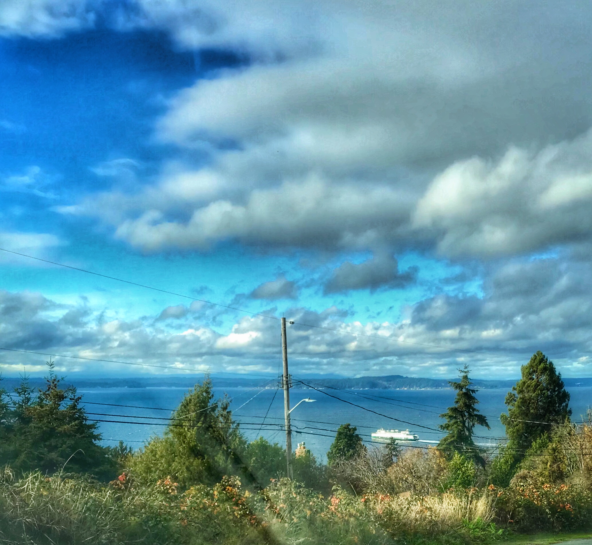
The image with the bridge is a northwestern view. The bridge is the West Seattle High Rise. The image with the most clouds is a southern view.
The Duwamish River is a working river as well as one used for transit out into Elliott Bay by fisherman and recreational use. The next posting will highlight some of those activities.


Tulip season is over, but I still have some images from our trip to the valley north of Seattle, so bear with me as I post another dozen or so images.


Well, what would a tulip farm be without a faux windmill and a herd of Honey Buckets?
Taken at Rozengaard Farm, Mt. Vernon, WA.,in the Skagit Valley.


")


Rummaging around the South Park neighborhood of Seattle on a Sunday morning.


Marine traffic on the East River, NYC.
Committed to amplifying underground independent sounds.
We Live In A Dynamic Universe of Energy
Finding the Extraordinary in Ordinary, Everyday Life
The Dedicated Blog for Inga Maria Hauser
Taking Control... Learning Contentment
Street and Urban Explorer Photography
Just another WordPress.com site
The Truth Sets Us Free
A daily selection of the best content published on WordPress, collected for you by humans who love to read.
Street and Urban Explorer Photography
Child Abuse and the Occult
The Random Things We See
Street and Urban Explorer Photography